

Let's Talk About Maps!
How many people remember the moment they first opened up their copy of Lord of the Rings, revealing the majestic world of Middle Earth for the first time?
How many hours have you spent staring at the magnificent map below?

Source: https://www.reddit.com/r/MapPorn/comments/15c97i/hires_map_of_middle_earth_2400x2424_xpost_from/
I’ve trapped you now!
In case you didn’t know, you’re about to dive into a blog all about maps; specifically, about the maps of my current WIP, a fantasy novel inspired by Lin Manuel Miranda’s Hamilton and the dangers presented by climate change! I hope you like maps, because . . .
I love maps! I’ve drawn maps since I was a kid. I remember making them on Microsoft Paint with no world or story in mind, just crafting continents for the hell of it. My fascination with maps translated into my love for the PC game Civilization, where every game includes a randomized map to develop and conquer.
So when I started writing fantasy stories, I knew I’d need to master the craft of mapmaking. Am I there yet? No, at least not when it comes to my artistic skills. But over the years, I’ve picked up a few styles I enjoy, and I like to think I learned a lot from staring at Tolkien’s world for hours on end.
Below, experience the first map drawn for my Work In Progress fantasy novel!

Yep, it’s rough. But it was a start, just about eighteen months ago. Through this beginning, I’ve created the world I’ve tentatively named “Endari.” And I’ve based my style on the map design of Tolkien. Am I to his level? Of course not! But let’s talk about Tolkien’s map for a moment, emphasizing why it works so well.
The Use of White Space in Maps
Many fantasy maps these days pursue a hyper-detailed style, sharing every facet of the world for readers to explore. I’m looking at you, Westeros. Yet Tolkien included detail in Middle Earth only where detail was needed. Look closely at the map above; where the Fellowship travels, he included numerous locations and details emphasizing the complex world surrounding their path.
Go beyond, toward places like Ruhn, Forodwaith, and Haradwaith, the map fades in detail. It’s mostly white space. This tactic achieves two goals for the story.
First, it focuses the eye of the reader on the parts of the map vitally important to the story. Everything’s lumped between the Shire and Mordor, and that’s where the Lord of the Rings occurs!
Second, the map appears as if it’s a map created in-universe. If this map is Elven or from Gondor, then the blank areas make sense within the context of the tale; they actually don’t know much about those places!
Returning to my map, you’ll notice most of the “details,” sparse as they might be, occur between the region titles “The Western Reach” and “The Eternal Sands.” Hopefully I’ve succeeded in drawing your eye toward those areas, for within that region of the map, most of Book 1 occurs!
Yet Everyone Still Loves a Map with Details . . .
Indeed, so like every good mapmaker, I explored the world beyond the edges of this first map. First, let’s take a look at the continent of “Endari!”

This map’s a lot messier than the last. I actually think it’s one of my worst maps, but it’s also one of the first to explore what the entire continent “could” look like. It’s at a high level, and it includes numerous locations that may or may not be mentioned throughout the narrative.
So what’s next? I sketched more detailed maps of each of the regions, making sure at least I know what the world looks like, even if the final story doesn’t include such detailed maps.
Hopefully you’re noticing that as I design these more detailed maps, I’m adding new locations, providing more specific rivers and mountain ranges, and exploring my world with finesse. If you’re struggling with the “geography” of your world, I’d suggest this technique. Start small (where your story takes place), go big, like way out, then focus on snapshots.

Pay particular attention to the coastlines. I’m adding island chains, shoreline details (think about what the Outer Banks of North Carolina look like), and adding roads and cities. Will I ever explore them? Maybe, maybe not. But it builds the nations of Endari.

The map above, exploring The Gulf of Icyni, is one of my favorite maps I’ve drawn. It includes more cultural features than most. The Icyni are a fascinating southern culture, dependent on the land and sea in a variety of fun ways.

This unfinished map features only the geography of the western provinces of the Shendari Empire. From a drawing perspective, I consider this one of my better drawn maps.

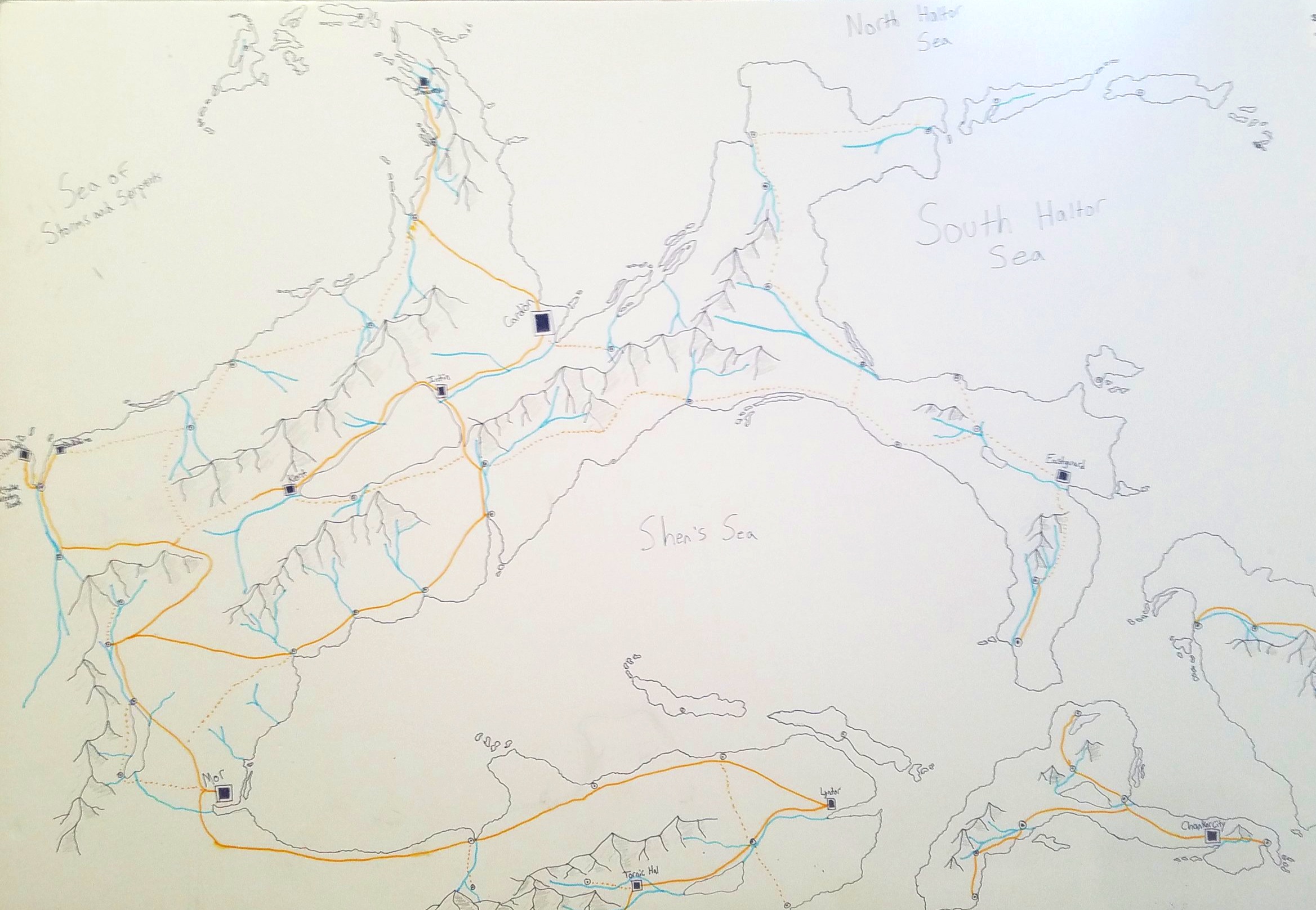
So after a tour of the larger world, we return to the region known as “The Western Reach,” where we began! I used this map, actually, to run a roleplaying game campaign for some friends (which included Brian J. Timm, my partner in crime at Two Doctors Media Collaborative). If you’ve not played a roleplaying game and you’re a writer, change that fast. It’s a great exercise in creativity.
You’ll notice this map experiments with a lot of color. I’m not sure I really like it. But the detail I included goes well beyond the first map I shared, and it allowed me the opportunity to develop this final map below.

If you’ve made it this far, you’ve gone on quite the round-about journey across the world of Endari. After all those places, it’s time to introduce the city of “Fendari,” meaning “New World” in the Shendari tongue. In case you can’t put it together, “Endari” means “World,” and “Shendari” means “Ruler of the World.” We can dive into linguistic development in a future blog.
Anyway, the majority of my WIP takes place in Fendari, a blossoming colonial town based loosely on Revolutionary New York City. Through this city map, I can actually “place” locations visited by characters, including the University in the south, Fort Yenrich at the confluence of the two rivers, and the Colonial Assembly in the center of town.
Through these maps, I’ve explored my world thoroughly. I’m sure I’ll make dozens more maps over the next few years, too!
But what’s next for my maps? Well, I’m not satisfied with my drawing skills. They obviously aren’t professional. So I’m exploring my digital options. One particular program, Wonderdraft, has caught my eye. Check it out.
Finally, I want to take a moment to highlight the maps of a fellow #WritingCommunity author who sent them my way this morning! Provided by Christie Powell, we’ve got a “detailed” map for Author use, and then a specific map with minimal details, just enough to entice the reader.


So that’s the end of the Book Builder’s Blog discussion on maps! But we can continue the conversation below in the comments or on Twitter. Do you draw maps for your stories?
Any questions about the maps provided?
Let me know!
Best,
C. D. Tavenor